
PlotView

Sell Projects Through Interactive Geospatial Experiences

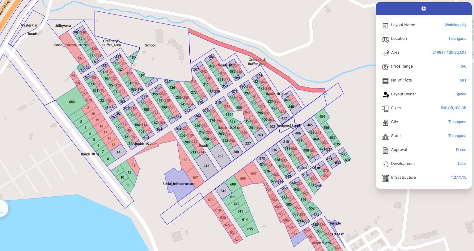
PlotView helps real estate developers market projects with interactive maps, drone imagery, proximity intelligence, 360° visualization, and live plot inventory.

PlotView product preview

What Can PlotView Do?

Explore All Modules

Everything PlotView Puts in Front of a Buyer

Sales & Marketing for PlotView
Sales & Marketing

Show buyers the project through interactive layout maps, live plot status, nearby amenities, and guided project visuals that make every sales conversation clearer. PlotView helps teams replace static brochures with a visual, map-led experience where customers can understand plot options, location value, and project highlights quickly.

Interactive Layout MapsInteractive Layout Maps
Plot AvailabilityPlot Availability
Nearby AmenitiesNearby Amenities
Project ShowcaseProject Showcase

How It Works

How PlotView Works

1
Stage 1

Inputs

Drone Survey • Layout Plan • Project Information • 360° Media

2
Stage 2

PlotView Platform

Interactive sales layer

3
Stage 3

Buyer Experience

Interactive Maps • Live Inventory • Virtual Experience • Location Insights

4
Stage 4

Outcomes

Better Customer Engagement • Faster Sales

Why Choose PlotView?

Interactive Property Exploration

GIS-based project layout and plot navigation.

Real-Time Inventory

Live available, booked, and sold plot status.

Drone & Aerial Visualization

Drone orthomosaics and aerial site context.

360° Virtual Experience

360-degree site views and virtual walkthroughs.

Location Intelligence

Amenity, landmark, corridor, and proximity layers.

Anywhere, Anytime Access

Responsive web access across desktop and mobile.

Deliver a Modern Property Buying Experience

Showcase your projects through interactive maps, immersive visuals, and real-time inventory to engage customers and accelerate sales.