Drones are making Progress monitoring
Easier,
remote & analytical
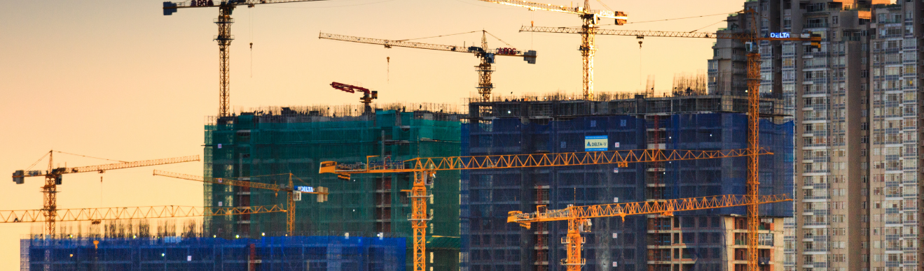
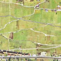
Aerial photogrammetry provides investors with a comprehensive view of the jobsite, from planning to completion.

40%decrease in
snag list compilation time

25%reduction in
reworks

50%Increase in
Stakeholder communication
40%decrease in
snag list compilation time
25%reduction in
reworks
50%Increase in
Stakeholder communication
We enable you to plan and remotely monitor the construction progress.
Drone based construction monitoring equips to make data-driven decisions for managing the construction
in a more cost effective manner saving both time and costs.


How drones help with progress monitoring

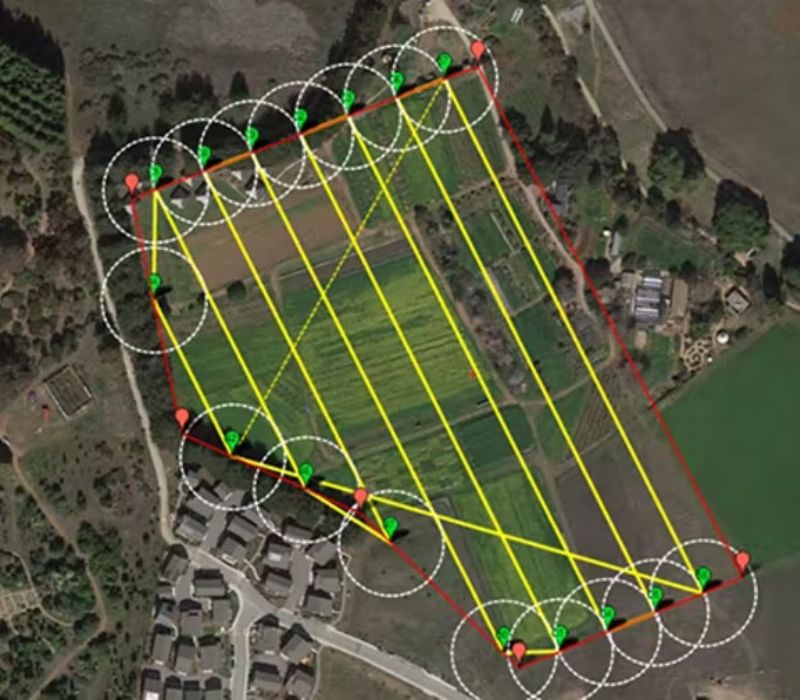
Frequent progress scans
Regular and frequent progress scans allow project managers to more accurately determine and update timelines as well as find areas of the project that are behind schedule

Stakeholder communication
Aerial imagery provides a comprehensive view of the jobsite, from planning to completion. Project leaders can share up-to-date details with investors and developers

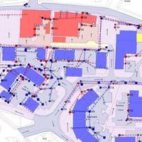
Monitoring tools
integration
We create overlays of CAD/BIM models with geospatial technologies to ensure the project is aligning with design plans. ML/AI are used to effectively track and monitor the progress of the project

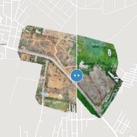
Temporal change monitoring
Progress Monitoring is periodic in nature, giving us an impressive timeline of the site progress. Having a detailed visual timeline provides you with greater visibility into the progress of your project

3D Realistic model
Drones are used to send real-time information to the engineers and project managers on the ground. At the same time, UAVs collect high-resolution data that can then be used to create realistic 3D models

Quicker Insights
A large amount of time is spent on aggregating the Progress Reports by manually visit to site, capture images and compile the snag list. With readily available actionable data, the time spent on reworks can be reduced significantly