Our solutions for all your
drone based needs

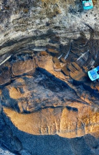
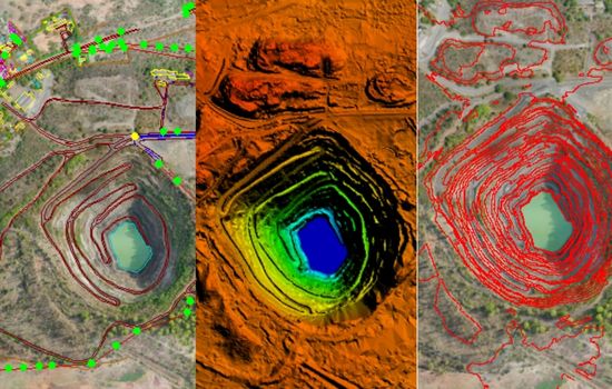
Drone surveying has risen in popularity over the past several years. With its
ease of use, reliable accuracy, and positive effect on worker safety, industry
is making the shift from traditional base and rover to drone surveying. Drones
offer enormous opportunities for surveyors and GIS professionals. We at polygon,
carry out surveys with the help of drones and process and deliver surveying data
in a timely, accurate and safe way.
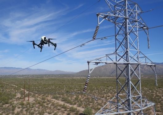
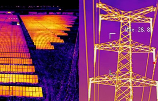
Traditional industrial inspection processes mostly involve use of ladders, ropes
and rigs to scale large machinery and towers. Understanding the industrial
process inefficiencies and identifying bottlenecks is a major challenge on a
daily basis. Drones provide a more efficient, cost-effective and safe inspection
process to monitor and maintain industry assets. Drones are widely used in Oil &
Gas, Utilities, Solar plant maintenance and Wind turbines installation and
maintenance.
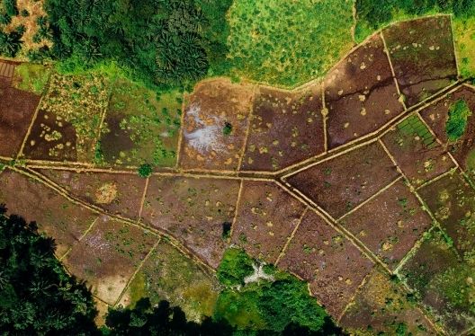
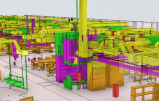
Progress monitoring is a recurrent activity throughout the project lifecycle to
ensure the project is progressing as planned. Drones enhance these activities by
providing visual aspects of the entire site, timely custom reports & providing
alerts when needed. This makes decision making processes much easier. We at
polygon, take an extra mile to integrate project monitoring solutions and BIM
solutions for better insights through digital twin technologies


The rise of drones is changing
the way surveying is done
Speed
Drones can scan acres of land in a fraction of the time it takes to manually survey on the ground, especially in areas of challenging terrain. A drone can capture data faster and safer, which may reduce costs
Precision measurements
Drone surveys can provide accuracy to less than 5cm GSD in measuring distances, volumes, and slopes. And these highly accurate measurements are all presented in photorealistic 3D maps
Inspection drones are transforming
manual inspection processes
Reduced Operational Risks
The use of drones to capture topographical site data means that surveyors don’t necessarily need to be on-site or in dangerous areas to acquire data, making accessing it safer and easier, especially in hard-to-reach areas
Asset Monitoring
Traditional methods that involved a surveyor needing to climb up an asset to generate data points with a GPS was time consuming, inaccurate, and expensive. Drone-based measurement, however, allows for lower cost, faster and more accurate information in just a few clicks
Drones track the progress
at all stages of a project
Improved Quality of Data
Drones are constantly scanning and creating thousands of measurements, resulting in incredibly detailed and highly accurate point files within a few millimeters, when paired with traditional survey methods
Track progress over time
Drone surveys are quick and easy to complete, we fly on a regular basis to capture the progress on their worksites. With this data, we compare worksite surveys to track progress, assess actual measurements against design, and proactively address any issues to ensure projects stay on time and on budget
Meet Our Collaborators

Trusted By Industry Leaders


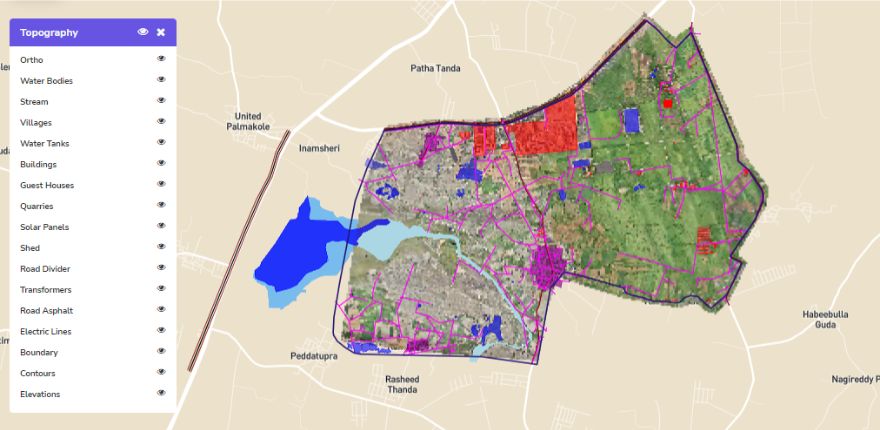
A comprehensive solution made for UAV
industry
with geospatial & AI methodologies
- Full stack SaaS Platform
- Interactive data input layers
- Manage & Visualize large spatial data
- 3D Visualizations
- End-to-End Solution providers
- Quick insights to the management
- Periodic monitoring
- Encrypted cloud access
- Domain specific project analytics dashboard